


Winter Storm Olympia Spreads Narrow Swath of Snow, Ice Into Northeast
Tuesday
Published:
Feb 16 2016 12:15 PM EST
Winter Storm Olympia's final chapter Tuesday includes a narrow swath of heavy snow and some temporary icy headaches for some in the East. However, unlike previous storms, Tuesday will be all wet along the I-95 urban corridor as warmer air surges northward.
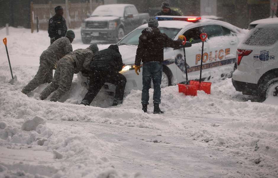
Icy roads have led to multiple accidents across North Carolina, South Carolina, Virginia, West Virginia and Pennsylvania since Monday, while more than a foot of snow has piled up in the western New York. This includes Rochester, New York, where 12 inches of snow fallen as of late Tuesday morning.
(LATEST NEWS: Hundreds of Wrecks Reported From Olympia)
Winter weather advisories and winter storm warnings issued by the National Weather Service for Olympia, continue from the western Pennsylvania and western New York to Maine.
(INTERACTIVE MAP: Latest Snow Reports)

Winter Weather Alerts
Watches, warnings and advisories, as issued by the National Weather Service.
Incredibly, just 48 hours after one of the coldest mornings in decades in parts of the Northeast, temperatures in the 40s and 50s have surged northward throughout the I-95 corridor.
This is due to the inland track of a low-pressure system moving from the South into the interior Northeast, pulling milder air into the region. As a result, unlike the past few winter storms, the threat of additional wintry weather will be confined to parts of the interior Northeast into Tuesday night.
The change Boston will see gives a good example of how much milder it will become as Olympia moves through the Northeast. After dipping to a low of minus 9 degrees Sunday morning, Boston will be in the 50s with rain and strong winds on Tuesday.

Latest Radar
Blue indicates snow, while pink is a wintry mix and rain is shown in green.
Below is our forecast timing for Olympia followed by the snow and ice forecasts.
(MORE: How Winter Storms Are Named)
Tuesday - Tuesday Night
- Most areas across the Northeast and mid-Atlantic have changed to rain.
- Strong winds are possible ahead of the low pressure as well, particularly in coastal New England where gusts of 50+ mph are possible Tuesday, which could lead to downed tree limbs and power lines. High wind warnings have been posted by the National Weather Service for parts of eastern New England, including Boston.
- A band of snow will persist from the Appalachians to western and Upstate New York, tapering off from south to north through Tuesday evening.
- FORECAST: Buffalo | Pittsburgh

Tuesday's Forecast
How Much More Snow
The heaviest additional snow accumulations will likely occur over western and central New York, including a stretch of the New York Thruway west of Syracuse, as well as Interstate 81 north of Syracuse. Storm totals in parts of this area will top a foot. Most of the accumulating snowfall will be over with after midnight.

Additional Snowfall Tuesday
A look at the additional snowfall expected Tuesday.
Olympia Snow and Ice Reports
Below is a listing of storm reports from Olympia by state since this past weekend. All reports are for snow unless otherwise indicated.
Arkansas: Freezing rain led to slick roads near Calico Rock
Connecticut: 2.5 inches in Colebrook; Glaze of ice lead to accidents on I-95 in New Haven
Delaware: 4.6 inches in Seaford
Illinois: 5.5 inches in Somonauk; 2.3 inches at Chicago's O'Hare Airport
Indiana: 5 inches in Martinsville; 2.2 inches in Indianapolis
Iowa: 5 inches in Ottumwa; 3.4 inches in Des Moines
Kentucky: 7 inches near Fonde; 3 inches in Louisville
Maine: 5.9 inches in Eustis; 3.6 inches in Portland; 0.25 inches of ice accumulation near South Windham
Maryland: 9 inches near Dowell; 4 inches in Salisbury; 0.25 inches of ice accumulation in Rawlings
Massachusetts: 3 inches in Lanesborough
Minnesota: 6 inches in Silver Bay; 3.5 inches in Park Rapids
Missouri: 3 inches in Perryville; 1.5 inches in St. Louis
New Hampshire: 4.4 inches in Portsmouth; 2.6 inches in Concord; 0.25 inches of ice accumulation near Stratham
New Jersey: 4.2 inches in Milton; 0.3 inches of ice accumulation in Wantage
New York: 14 inches in Greece; Snow at rate of 2 inches per hour Tuesday morning in Buffalo and Rochester; 0.25 inches of ice accumulation in Watervliet
North Carolina: 5.5 inches in Crumpler; 4 inches in Boone; Light icing has caused numerous accidents in the Raleigh and Charlotte areas as well as other parts of the state; Numerous trees and powerlines downed in Morganton, Hendersonville, Rutherfordton and Marion. Up to roughly one-half inch of ice has been reported in Flat Rock and near Glen Alpine.
Ohio: 7.6 inches near Newton Falls; 6.4 inches in Youngstown
Pennsylvania: 11 inches in Utica; ice accumulation just under 0.5 inch in Clearfield
South Dakota: 6 inches in Aberdeen
Tennessee: 6 inches in Mountain City; 4 inches in Bristol; Numerous wrecks due to icing in Wilson County Sunday; Numerous accidents due to icing on I-24 near Clarksville Sunday
Vermont: 5.1 inches near Sutton; 0.5 inches of ice accumulation near Johnson
Virginia: 12 inches in Wytheville; 10 inches near Blacksburg; ice accumulation of 0.4 inches in Drakes Branch
West Virginia: 11 inches near Bluefield; 8 inches near Huntington; ice accumulation of three-eighths inch in Martinsburg.
Wisconsin: 4.3 inches near Park Falls; 2.3 inches at Milwaukee's General Mitchell Airport
Tempestade de neve cancela voos e para costa leste dos EUA
atualizado em 16/2/2016 às 11h50

- 1
- COMENTÁRIOS
Uma tempestade de inverno atingiu boa parte da costa leste dos Estados Unidos nessa segunda-feira, com acúmulos de neve e gelo previstos para as próximas horas, e mais de 1,5 mil voos cancelados em dia de feriado no país, em sua maioria nos aeroportos de Washington, Baltimore, Nova York e Carolina do Norte.

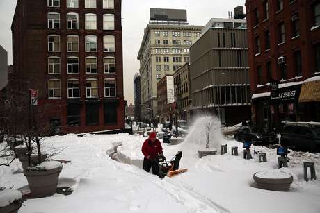
Em 25 de janeiro de 2016 a Costa Leste dos EUA teve um novo recorde de queda de neve em um único dia. Na imagem, um homem limpa sua calçada no Brooklyn, em Nova York.
Foto: Spencer Platt / Getty Images
Segundo o Serviço Meteorológico Nacional podem ser registrados acúmulos de neve de até 15 centímetros em algumas áreas e também de gelo, razão pela qual se recomenda extrema precaução na circulação por estradas.
Após a neve e o gelo estão previstas chuvas localmente fortes a partir desta noite, sobretudo no sul, onde há risco de inundações e alerta de possíveis tornados em estados como Mississipi e Alabama.
Em Nova York, o prefeito Bill de Blasio fez um pedido para que se extreme o cuidado entre hoje e amanhã porque as vias estarão congeladas por causa da neve que estava caindo desde meio-dia e das baixas temperaturas registradas.
"Embora as temperaturas estejam subindo, o chão ainda está congelado pelo frio deste fim de semana", disse De Blasio em mensagem divulgada por seu escritório de imprensa.
Segundo o Serviço Meteorológico, a neve que estava caindo hoje em Nova York derivaria pela noite em chuvas moderadas ou intensas, com precipitações que se prolongarão até terça-feira, acompanhadas de fortes ventos.
Não houve interrupções nos sistemas públicos de transporte e as autoridades alertaram também sobre a possibilidade de que o temporal gere inundações nas áreas litorâneas.
Nenhum comentário:
Postar um comentário